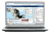
What is DEO?

What is DEO?

Datapages Exploration Objects™ – DEO – is a web-based search-and-retrieval system that enables exploration geologists to find and retrieve geo-referenced, GIS-ready maps, cross-sections, seismic lines and other exploration objects faster and more easily than ever before.

The key: we’ve isolated, geo-rectified and indexed maps, figures, tables, seismic lines and other exploration objects from articles published by the American Association of Petroleum Geologists and a continually growing list of content partners, now including more than 55 petroleum geology organizations.

The DEO index currently includes more than half a million entries, with some 385,000 captioned figures, 67,000 tables, and every map in the Archives since 1989.

DEO mines this deep index with the power and speed of the latest information technology – putting a whole new world of exploration objects literally at your fingertips, all downloadable GIS-ready and with complete support files for GIS-import.

Finding the exploration objects you need – digging through publications, extracting maps, tables and other objects, and making those objects GIS-ready – used to take hours or even days. With DEO, you can do it all in minutes.

The result? Major savings in labor, time, and dollars – hundreds of dollars on every map, cross-section and seismic line you use. And better-informed decision-making – with less delay.

The payoff: DEO can help make any organization relying on exploration geology more competitive – and more profitable.

For explorationists around the world, DEO is the new gold-standard in search and retrieval.

Datapages Exploration Objects

Availability: DEO is available for subscription now.

DEO is a supplement to the AAPG Datapages Archives and requires an Archives subscription in place. Access via the Internet is controlled under the same IP Authentication Admin process.

DEO subscription is for one year. Subscription levels are based on the type of organization subscribing and on the number of users covered by the subscription.

Phase 1 & Phase 2 Development - Complete

  • Deep index of titles and figures, currently with some 525,000 entries with 385,000 captioned figures and 67,000 tables. Data fields include title, author, reference / citation data, publication type, date, etc., together with URL locations hyperlinked to title articles and figures in the AAPG Datapages Archives.
  • Spatially-enabled figure index with figures linked to countries, states, provinces, counties, basins, fields and eventually wells.
  • Vectorized basin outlines, field location, cross‐section and seismic section location lines, map footprints, and well locations matching geo-located and geo-referenced figures
  • Every map in the AAPG Datapages archives, 1989 – 2010: 35,000+ geo-rectified maps (referenced and projected to real-world coordinates): structure, isopach, geology, gravity and magnetic maps.
  • Second set of 10,000+ maps, including 4,000 objects from Exploration Fabric Africa (EFA) project.
  • 10,000 additional seismic lines, cross-sections and more.
  • Enlarged collection of maps, sections and seismic lines for Mexico.
  • Interface enhancements.
  • New technology options for corporate users. Watch for announcements or contact us.
  • Highly competitive pricing: Varies with the size and type of the subscribing organization.

For more information: simply click here.


DEO Features

  • Exclusive content from the AAPG Archives – available only from AAPG Datapages.

  • Intuitive, flexible Search & Retrieval. Search by text or by "drawing" on the interactive DEO map.
  • Fast drill down to items you need – by quick, easy filtering of search results.
  • Click back to the original source. To evaluate any object in context, with DEO the article that is the object’s original source is always only a mouse-click away.
  • Live overlays. By adjusting object opacity in the DEO display, you can even examine objects as stacked overlays on the DEO background map – to “preview” composited data before downloading the objects you select.
  • Delivered GIS-ready. With DEO, each object is geo-rectified (assigned lat./long. values), manually classified as to image quality and legibility, and delivered in industry-standard GIS format for fast, easy conversion for use as information layers in GIS.
  • Access from any computer – anywhere: PC, Mac, Linux with access via the Internet. No software installation required!
  • Multiple advanced delivery options. Access DEO via ArcGIS or Geoportal. Local installation of the DEO index – regularly updated. – for local access control, reduced Internet traffic and total integration with your GIS.
 And more. We'll work with you to tailor DEO to your corporate needs and IT requirements.

  • Quality assurance. All maps are manually assessed and classified by AAPG experts as to locational accuracy and readability – with metadata enriched to remove search obstacles: spelling and nomenclature variance, missing information, errors, etc.
  • Availability: DEO is available for subscription now.


DEO is a supplement to the AAPG Datapages Archives and requires an Archives subscription in place. Access via the Internet is controlled under the same IP Authentication Admin process. DEO subscription is for one year. Subscription levels are based on the type of organization subscribing and on the number of users covered by the subscription.

© 2015, Datapages Inc, All Rights Reserved